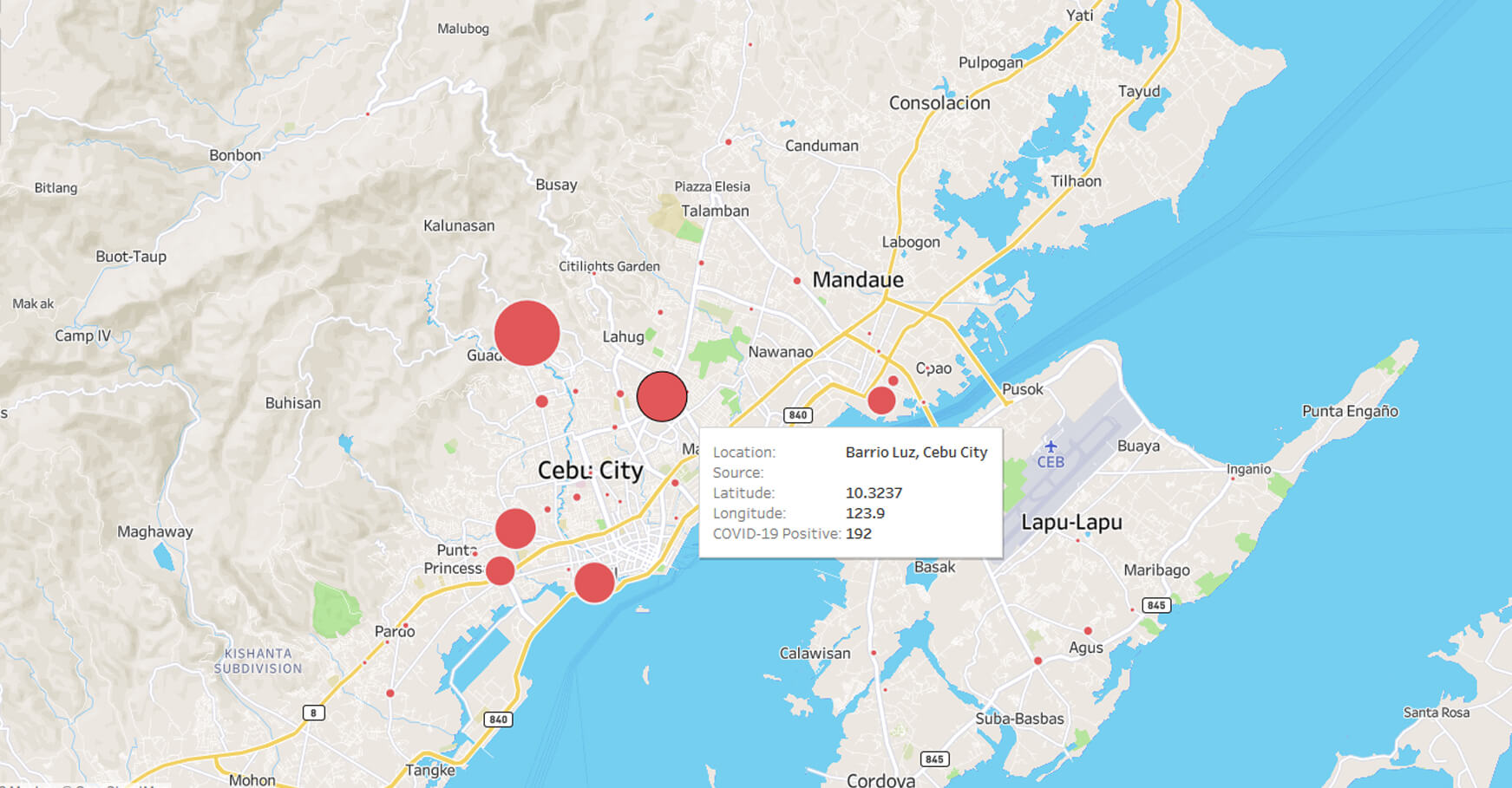
More cases of COVID-19 infection have been detected in areas throughout the country. Cebu City is among the areas with an increasing number of confirmed cases. These infections are clustered in the city jail and communities like Barrio Luz, Barangay Suba, and Mambaling.
Below is an interactive map of confirmed COVID-19 cases in Cebu. It is being continually updated so please bookmark this page. We are synchronizing data with publicly available statistics released by local government units. We published below the maps sources of our data.
Open source: the data is publicly available through an online spreadsheet here. Please feel free to check the data for veracity and currency. If you spot errors or have data that could be added, feel free to contact us via Facebook Messenger on our MyCebu.ph page. If you want to collaborate on this data mapping, do message us above or send an email to [email protected].
An important note on the location of map pins: we based it on the GPS coordinates of the barangay halls as indicated in Google Maps.
We are focusing on Cebu because it is the site’s audience but if data is available for nearby provinces, we will add it to the map.
The markers contain the source of the information and the date of the update.
Our sources of the data include:
- Cebu City: From the Facebook update of the Cebu City Health Department
- Mandaue City: Update by the Mandaue City Public Information Office and an April 30 map that indicated number of cases that it posted.
- Lapu-Lapu City: We are currently lagging behind the data for Lapu-Lapu. What we have are figures included in a map shared on April 30 by Lapu-Lapu City Crisis Manager Nagiel Banacia. Mayor Junard Chan announced that the number of cases in Lapu-Lapu City is now 40 but the figure is not reflected on the map as we still do not have a breakdown of their barangays. We will update as soon as we get the information.
- Talisay City from the Talisay Public Information Office.
- Cordova: Announcement by Mayor Teche Sitoy-Cho.
- We are reviewing and reconciling data for Cebu Province. We will add it shortly.